 Bluetooth GPS , see http://www.pocketgpsworld.com/gs-r238.php
Last updated March 2010. Never uptodate. Technology changes on a monthly basis
See also the XC Africa 04 Live Tracking article by Alistair Stuart
I flew using Nokia 6170N and a 6110 Navigator.
Tested various solutions with the build in GPS.
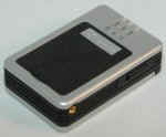
Or with a GS-R238
Bluetooth GPS , see http://www.pocketgpsworld.com/gs-r238.php
The unit is about matchbox size.
( Available from Laura Nelson, funwings at global.co.za) . Suitable for users who have an existing application running on their cell phone.
And run out of battery power on their cell phone internal GPS.
Also flew with a Bluetooth enabled Braeuniger 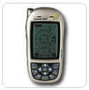 Competino+ http://www.brauniger.com/english/products.html
Tested ![]() the
CARSCOP CCTR-700 GPS Tracker. Made for car tracking.
the
CARSCOP CCTR-700 GPS Tracker. Made for car tracking.
Can be phoned to return current location. Got a SOS button. Got a track log memory.
To send a location SMS at a regular interval, has to be triggered by a SMS message. Not exactly what you want to do when you are ready to launch.
I like the query and SOS button. The other functions, for me, are to clumsy to use in a flying environment.
When you are not flying, you can leave it in your car. In case the car gets stolen, you can track it using the other functions of the unit.
A cellphone battery goes flat within 2-3 hours when the internal GPS is enabled.
Using the Nokia build in GPS option, the battery of the cellphone is not lasting long enough to be used for live tracking a pilot.
The pilot lands with a dead phone. With no possibility to SMS a down and safe.
One option would be to extend the battery life, by connecting an external battery.
Or have some external hand driven charger after landing to beef up your cellphone battery.
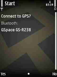
Or use an external GPS via Bluetooth.
Got myself an external bluetooth GPS. The GS-R238 has a battery life on its own of about 8-9 hours.
One recharges the GS-R238 via a bluetooth interface cable using 5 Volts.
The GS-R238 , or any other bluetooth GPS, is suitable for users who got their own application, like ReliRescue, Google Maps, Nokia Sportstracker,.. and need a longer battery life of their cell phone.
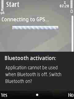
Deactivate in the Nokia the Internal GPS when flying with a Bluetooth external GPS.
In the Nokia 6170N you find this in Settings - Settings - General - Positioning ,
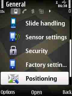
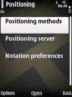
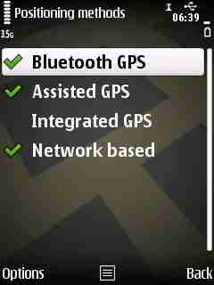
Deactivate Integrated GPS
And activate Bluetooth GPS
Software that I used was
- Vodacom Look4Me http://www.look4me.co.za/
- Braeuniger Comeptino+ with Bluetooth and SMS location in a regular interval to another phone
http://www.brauniger.com/download/Bluetooth_and_SMS_Setup_Eng.pdf
- Braeuniger Comeptino+ with Bluetooth using NMEA Option to http://www.livetrack24.com/
- Google Maps Latitude with Nolia 6110 GPS http://www.google.com/mobile/maps/index_.html
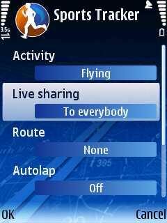
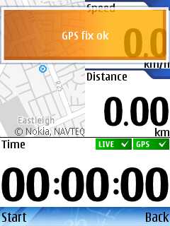
- Nokia Sportstracker http://sportstracker.nokia.com/nts/main/index.do
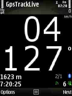
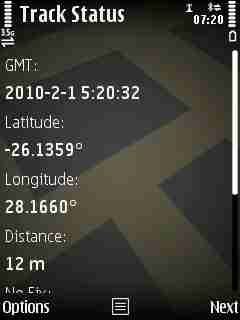
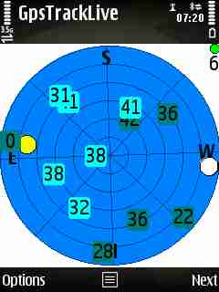
- My own written code, TrackMe and TrackTweet http://gpstp.sourceforge.net/
Interested in, checking for ...
- Ease of use, switch on and it works. Do not want many steps in a certain sequence ....
- Should figure out that you crashed and send out an alert. Without you having to do anything to trigger it.
- Everyone can see your location. Not a selected few, who do not know you are in trouble.
- Can be used by a recovery driver while driving. Or by a volunteer student recovery driver who happened to be on the field today.
- total costs,...
- Ability to query cell phone and ask it for your location
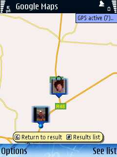
Example screen shot with no GPS connection and relying on cell phone tower location info.
Done at Bambi take-off
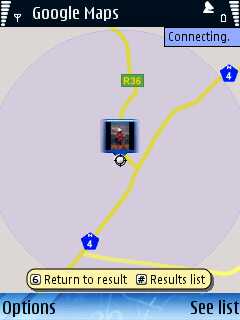
The system puts me at the location of the cell phone tower at Bambi Hotel Lydenburg road turnoff.
Which was 5.3km away from my true location.
Once the system has established my GPS coordinates
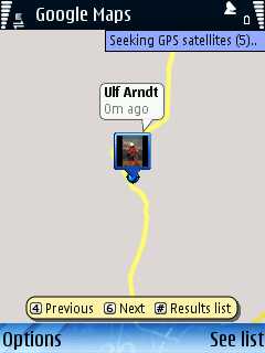
I am spot on, at the correct place.
I reckon relying on cell phone tower based location is not suitable for getting located out there in the bundu.
One has to use a GPS and send your location data via GPRS or SMS.
Easy to use, switch on cellphone = works, Contract, costs R1 per query, very inaccurate, 10km or more out there in the bundu = useless ?
Does not recognize if you are crashed, needs you to trigger an alert.
Multiple persons can query your location. If you are in cell coverage. No cell coverage = no idea where you are?
As a once off intial setup one has to configure the Competino+ once. with your Bluetooth enabled cell phone.
From then onwards it is a simple ...
and it will work.
If you forget to enable Bluetooth on your phone before takeoff, one can always switch on the Bluetooth on the phone while in the air.
The Competino+ will connect and start sending all the accumulated location data.
The Competino+ recognizes landing ( or crash = no more movement ).
And if there is no more interaction by the pilot with the unit, then it sends an emergency SMS.
Only one person can get the SMS. And that person...
If that person's SMS buffer is full, tough, your messages are not getting through to your recovery.
The Competino+ stores, buffers, SMS when it can not send and tries in regular 1 minute interval while flying, to send them.
If you land in no cell coverage, one has to rely on last coord, that made it. Which can be 15km out.
Costs are around 30-70 cents per SMS.
Download free LiveTrack code from http://www.livetrack24.com/
Register, install code, configure once the Comeptino+ and cell phone.
http://www.livetrack24.com/wiki/images/Competino+GpsLiveTrack.doc
Before takeoff...
... and then you are sending data to the server. What is a number of interactions required before taking off.
And now your Bluetooth enabled phone works like a GPS ....
One can send every 15 seconds to 1 minute your location. Costs are around 1 cent per location transmit.
But ... LiveTrack code tends to loose connection to Internet or Competino+ in a South Africa coverage environment.
By default phone does not auto reconnect. You fly, and you are not sure if you still transmit.
Unless you find an option in your phone to define the default network connections and enable it to reconnect automatic.
Once landed, it requires manual stop and confirmation if you are ok or not.
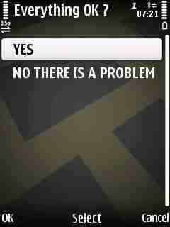
You can have a manual triggered SMS alert that you are in trouble.
If you crash,... there is no automatic trigger to give out an alert when there is no interaction with your unit.
LiveTrack is good if you want your folks at home to see where you are.
It is not so good for your flying buddies, who are stuck at work, to see via Internet that you are flying.
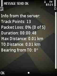
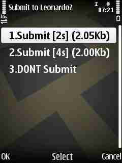
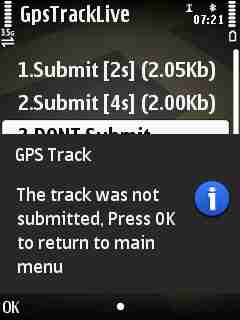
LiveTrack keeps a track log in your phone. One can submit a track log immediate after landing for scoring.
But I stopped using it when code somehow managed to make my phone hang, and I had to reboot the phone from scratch to get it working again.
JAVA J2ME based solutions, when loosing connection, can not re-establish by themselves a server connection.
They require a user confirmation. And while flying you do not realize that the cellphone connection has to be reset.
Also I am not convinced that it is a good recovery driver solution.
Or for the flying buddies at the field, looking for you, now need an Internet access to figure out where you are?
My current preferred solution.
Install free code from http://www.google.com/mobile/products/latitude.html#p=default , register, add some "friends".
From then onwards,... activate it on your phone, and it runs. I keep mine on all the time.
Can use cell phone tower location, or runs with a build in or bluetooth GPS.
Friends can see you in relation to their position on phone.
No need to interprete coordinates.
Here is an example of a pilot coming towards me in a recovery vehicle in De Aar.
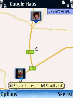
A recovery driver or flying buddies, if they are registered as friends of yours, can see your location relative to their own on their cellphone.
And registered Friends can see your current location on the Internet via http://www.google.com/ig?referrer=ign_n#max8
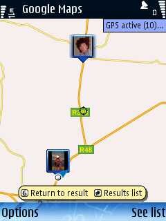
But in De Aar towards Prieska the system becomes unreliable if one uses cell phone location based info only.
One jumps around, from Rio de Janeiro in Brazil to Amman in Jordan, and then to Ceres in the Cape.
Unless one activates the GPS and then one is on the correct location.
Network costs are Internet GPRS rates based, which adds up to about R30 a month for me, having it on all the time.
It offers no track logs.
My take ....
Google Maps has to be operated in combination with a Bluetooth GPS and then it is a nice recovery solution.
But it has no emergency crash notification solution.
http://gpstp.sourceforge.net/TrackMeDoc/html/v2/TrackMe-2.html
Can be downloaded for free from http://gpstp.sourceforge.net/
for Nokia Bluetooth enabled S60 phones.
SMS your location every x minutes. Option to only send SMS if you are a certain distance away.
Can be queried by another for via SMS for your location.
Sends SMS only to one person.
Has to be used in combination with a bluetooth GPS unit.
No emergency SMS crash function yet. ( Might come out with next release )
Relies on the cellphone to send an SMS. In a bad coverage area, SMS get queued by the cellphone.
With a 6110, the phone retries to send buffered messages.
The 6170N does not retry often enough. As a result, you land, and find most of your SMS are stuck in your phones Outbox. = Bummer
http://gpstp.sourceforge.net/TrackMeTweetDoc/index.html
JAVA J2ME based code. Instead of sending a SMS, sends a Tweet of your location data to Twitter.
Everybody in the world, who opts to follow your Twitter entries, can get your location updates.
But, when it looses server connection, the JAVA J2ME security specs require a user acknowledgement to reconnect to the server.
Same problem like Leonardo LiveTrack. You fly, connection gets lost, and you are not aware of it, and code hangs up cellphone = bummer.
Unless your phone got somewhere a function to define a default network provider and a way to allow auto reconnections.
Free download
Works only on Windows Mobile phones
Can be used to query your location.
Can send SMS to multiple other phones
Written for HG and PG pilots and recovery drives. Unfortunately Windows ME only.
http://sportstracker.nokia.com
For Nokia phones only
And one can see your location on the Internet like this
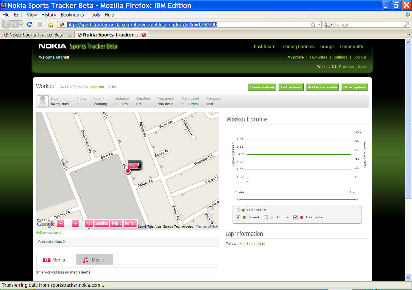
Did not test it very much. Can not comment on its usability for PG
http://en.wikipedia.org/wiki/Cospas-Sarsat
Price tag around R6500. Weight around 250 gram.
Has to be activated manually. Does not kick in automatic when you crash.
Works everywhere outdoors.
Triggers immediate search and rescue .
http://www.gme.net.au/public/pdf/manuals/mt410_g_8_im.pdf
Too heavy and bulky for flying with a paraglider?
Not clever enough to figure out that you have crashed. Needs pilot to activate it.
If one can find a unit that is small enough and clever enough to figure out that you crashed, then it would be ideal.
SPOT is not covering South Africa http://www.globaltouchwa.com/coverage.html in February 2010
http://www.aspicore.com/en/tuotteet_tracker.asp?tab=2&sub=2
http://www.trackmyjourney.co.uk/
http://www.reperion.com/ and http://tracker1.reperion.com
http://java-phones.com/download/trekbuddy-0993
SAR rescue coordinator 082 823 8493
Standby list of CAA http://www.caa.co.za/resource%20center/accidents%20&%20incid/Standby%20Notice.htm
Fly,Crash,Survive http://stpxml.sourceforge.net/skygod/Navigation/fcs.html
How to use a GPS http://stpxml.sourceforge.net/skygod/Navigation/gpsinfo.html
Vodacom coverage http://www.vodamap.net/3g/
MTN Coverage Map http://www.mtn.co.za/MTNSERVICES/BROADBAND/Pages/CoverageMap.aspx
APRS - HAM Radio with GPS http://en.wikipedia.org/wiki/Automatic_Packet_Reporting_System
The XC Africa 04 Live Tracking article by Alistair Stuart